
Why there’s more to Myton than meets the eye

The Way it Was
In partnership with Hull History Centre
By Neil Chadwick, archivist/librarian
Myton as a name has largely fallen out of use today.
Ask those living in what is historically Myton, and they will tell you they perhaps live on Hessle Road, Great Thornton Street, Spring Bank or perhaps the Marina.
Myton as an electoral ward was retired by Hull City Council in 2018. Despite this, Myton is still woven into Hull’s fabric.
Its name lives on through amateur rugby club Myton Warriors, Mytongate, Myton Bridge and Myton Street.
With work due to be completed in the coming months on Mytongate, Castle Street and the wider A63, this, along with the recent Castle Street archaeological digs, has meant Myton has received increased attention over the last couple of years.
Geographically, Myton is roughly bounded to its west by what is today, Walton Street, Walliker Street and West Dock Avenue. To its south is the Humber Estuary, to its east is Hull’s Old Town, while North Myton borders Spring Bank and Marlborough Avenue.
Early Myton
The hamlet of Myton pre-dates Hull. Its name derives from Danish settlers of the ninth century. Its name means ‘farm meeting at two rivers’.
Prior to the Norman Conquest, Myton was a lordship of around 900 acres. In 1086, Ralph Mortimer was Myton’s tenant and chief. Later landholders included Sir William Aton, Maud Camin and Meaux Abbey.
It was here that Meaux Abbey founded a chapel almost a century before that of Hull’s Holy Trinity, now Hull Minster.

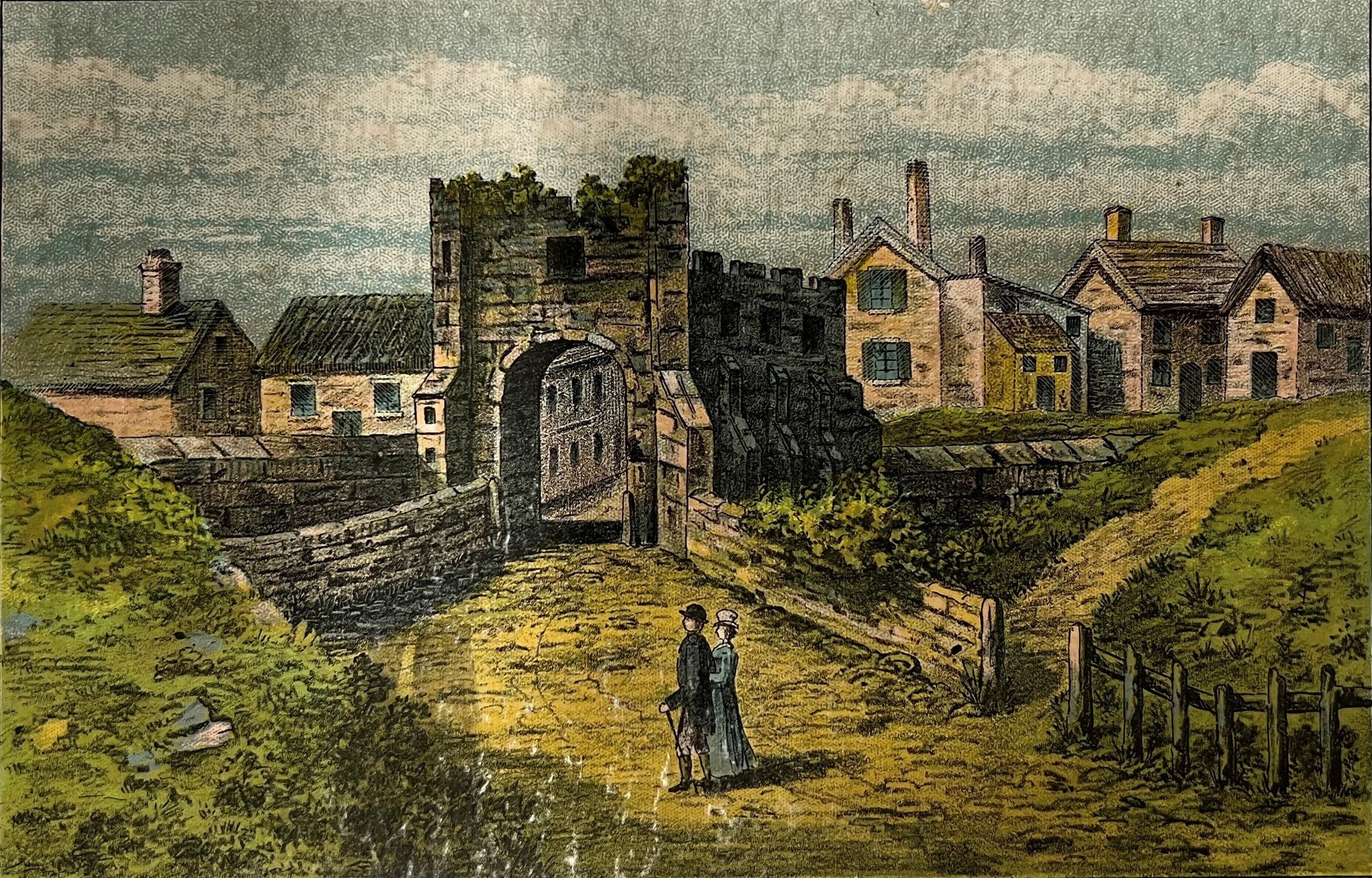
Carr Lane mid-18th Century, looking east to Hull with the original White Horse Inn on the left
The precise location of the hamlet of Myton is unknown. Although lost, a clue as to its location can be traced with the line of Mytongate.
Originally Lyle Street, Mytongate today is one of Hull’s main arterial roads, and was once the principal street leading to the hamlet of Myton.
Following the line of Mytongate, the hamlet of Myton was more than likely located around the area of the former Mytongate roundabout, close to what is today, Commercial Road and the Castle Street burial ground.
For centuries, Myton remained separate to the town of Hull. Though the manor was granted to the Corporation in 1552, Myton remained rural. Even by the later 18th century and with-it industrialisation, Mytongate was described as an airy, open street, often viewed as a ‘fine walk’.
Elsewhere in Myton several mills, brickworks and a small number of isolated dwellings would have scattered the landscape before its later urban development.
A place of punishment and execution
Myton was the later location for Hull’s town gallows. Once located along what is now Prospect Street, the gallows were re-located by what is today the A63, formerly a part of Waverley Street.
What is now Great Thornton Street, was known as Gallows Lane. It was at the joining of Great Thornton Street and Waverley Street that the punishment of death was carried out.
The last man to be publicly executed here was John Rogerson. Rogerson was found guilty of counterfeiting coin and sentenced to hang.
During the English Civil War, the defending parliamentarian forces established a gun battery close to the town gallows, to repel any royalist attack from Hessle and Anlaby.
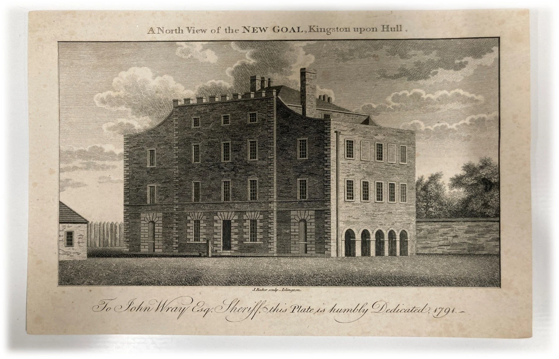
The jail of Castle Street
Myton later became the centre of criminal punishment. Hull’s former jail, located between the Market Place and Queen Street became insufficient and was replaced with a new jail, situated just beyond the town walls in Myton on Castle Street. Originally built to house 22 prisoners, it opened in 1785, but this too became inadequate with more than 30 being housed at any one time.
It was decided that a new jail was needed. And again, Myton was the chosen location, but this time on Kingston Street, just a stone’s throw away from the jail on Castle Street.
This new jail or ‘House of Correction’ as it was known, opened in 1829. Located on the eastern side of Manor Street, it was made up of five blocks radiating from a central hub.
In 1835 the average daily population was 85. However, like its predecessor, this too became inadequate, and a new jail was built in 1865 on a 12-acre site on Hedon Road, now of course Hull Prison.
19th Century urban development
By the turn of the 19th Century, Hull had begun to expand north, and west into Myton.
Desirable properties appeared in an area referred to as ‘English Town’. English Town centred around English Street and was developed by merchant Thomas English. Belle Vue Terrace and Lister Street were two such streets consisting of these desirable properties.
To serve Myton’s expanding population, the church of St James was built in 1831. Located in St James Square, Lister Street, the church had seating for 1,000. It closed in the mid-1950s and was demolished in 1957. The site is now a small garden.
The original layout of English Town is still visible, though the properties have long since disappeared, with the area now home to industry and small factory units. In 1837, Myton was incorporated into the Borough of Kingston upon Hull.
Smith & Nephew
Perhaps the most recognised name associated with Myton is that of Smith & Nephew.
Established by Thomas James Smith in 1856 as a dispensing chemist, shortly before his death Thomas was joined by his nephew, Horatio Nelson Smith and the business became known as T J Smith and Nephew.
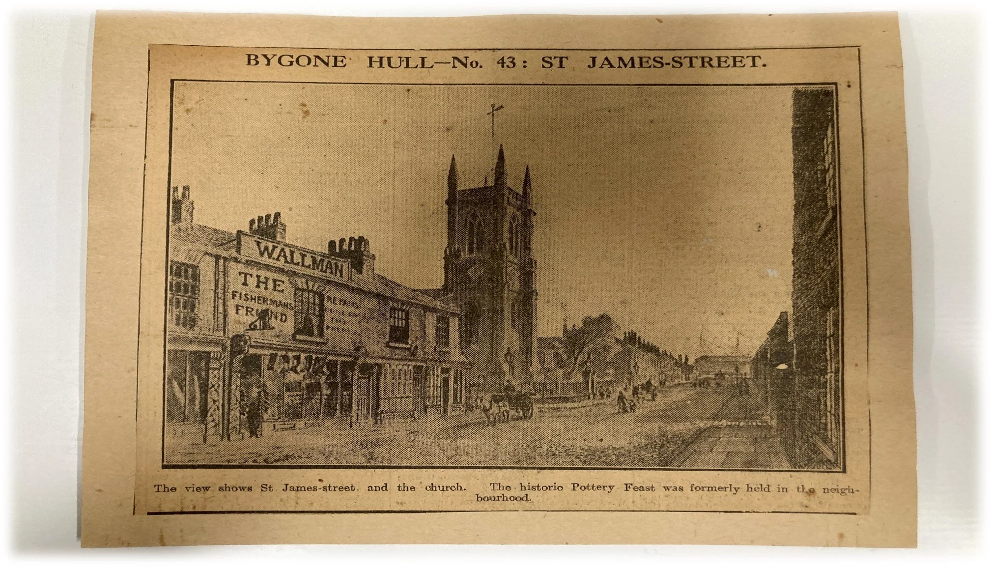
St James' Church, Myton
It was under Horatio’s leadership that the company transformed. In 1906, larger premises were needed and the company moved to its current site in Neptune Street – a step up from the days of Thomas Smith’s premises on Whitefriargate and later North Church Side.
The Potteries
Another name that has long fallen out of use in Myton is ‘The Potteries’.
Situated close to English Street, it derived its name from the pottery of William Bell, established in 1826 on the area around what is today Kingston Retail Park.
Taking ‘Belle Vue’ after the affluent terrace nearby, Belle Vue Pottery ended production in 1841, and with it, its unofficial name – The Potteries – fell out of use.
Population growth
As industrialisation brought huge swathes of the country’s population to the growing towns and cities of industrial Britain, Hull, and with it, Myton, saw its population dramatically increase.
Myton’s population in 1821 was just over 10,900, with 2,400 houses. Within 20 years the number of houses and population had doubled, and by 1861 Myton’s population was just shy of 40,000, with 8,500 houses.
To accommodate the growth in population, cheap and poorly built houses – more commonly known as slums – filled much of Myton. And with it new and existing streets were developed. This included Great Passage Street, which itself was probably an older ancient road.
Upper Union Street, Nile Street and Fawcett Street to name a few were laid out and built upon. The once airy, open spaces were now taken up by housing. By 1881, Myton’s population had reached almost 65,000 – the population of a small town today.
Myton’s residents included butchers, shopkeepers, greengrocers, Master Mariners, watchmakers and labourers, all of whom lived and worked in the area. Osbourne Street for example, was very multicultural, not only home to a large Jewish population, but also included other nationalities and religious creeds.
Great Thornton Street
At Myton’s eastern edge, just before Hull’s Old Town, was The White Horse Inn, which pre-dated the current White Horse public house.
Built from the mid-18th Century, it was situated on Carr Lane, which was the main route to Hull’s west, slicing through Myton at its eastern edge before linking up with Anlaby Road and the Carrs to the west.
The White Horse Inn had a rural feel, a far cry from the busy scene we see today. The present White Horse public house (now Star) dates from 1956.
Modern development
The post-war years saw much of Myton’s development we see today.
Perhaps the most recognised is the area around Great Thornton Street. Here, Victorian housing has given way to modern high-rise flats and housing.
Icelandic Close, for example, was developed thanks to funding from the Icelandic government in memory of those fishermen who lost their lives.
Adelaide, Melbourne, Wellington and Auckland House were all built in the early 1950s.
The high-rise flats along Anlaby Road were under construction in 1963 and began to take their first residents in 1965. Earlier flats built between the wars are still occupied, most notably those on Cogan Street, Adelaide Street and Porter Street.
The construction of the A63 was one of the catalysts for change on Myton’s southern edge in the 1980s.
Mytongate and the stretch of Hessle Road from Great Passage Street was turned into a dual carriageway, replacing the stretch of Hessle Road once known as Patrick Ground Lane, believed to have been named after a local tanner, Patrick, who had property in the area in the 19th Century.
Elsewhere, the former Borough jail is now site of the homes built in the city centre during the 1980s between Kingston and Wellington Street. Other streets that have long ceased to exist include Wakefield Street, Spruce Street, Fawcett Street and Burton Street, while properties on Daltry and Madeley Street have given way to the Daltry Street flyover which now forms the slip road on and off the A63.
What was once largely residential now forms a large part of Hull’s culture and leisure facilities.
The ice arena and Kingston Retail Park are popular visited venues for shoppers and those seeking fun, whilst Connexin Arena has hosted some of music’s biggest names, including Bob Dylan, Blondie, Noel Gallagher and Ne-Yo.